 t-nacan-00007
← Collection
images
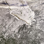
Ice-covered James Bay, Canada
- Reference
- t-nacan-00007
- Date
- 2009-01-19
This image, acquired by Envisat’s Medium Resolution Imaging Spectrometer (MERIS) instrument on 6 January 2009, features an ice-covered James Bay in Canada’s Nunavut territory, with the provinces of Quebec (right) and Ontario (left) visible. James Bay – the southern inlet of Hudson Bay – contains numerous islands including the crescent-shaped Akimiski Island (visible in the upper left). The two islands visible as round white holes some 50 km northeast of Akimiski Island are the Twin Islands, while the large island visible at the very southern end of the bay is Charlton Island.
Contact →