 a-mar10-00021
← Collection
images
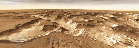
Mars - Noctis Labyrinthus
- Reference
- a-mar10-00021
- Date
- 2010-12-10
West of Valles Marineris lies a checkerboard named Noctis Labyrinthus, which formed when the Martian crust stretched and fractured. As faults opened, they released subsurface ice and water, causing the ground to collapse. This westward view combines images taken during the period from April 2003 to September 2005 by the Thermal Emission Imaging System instrument on NASA's Mars Odyssey orbiter. The pictured location on Mars is 13.3 degrees south latitude, 263.4 degrees east longitude.
Contact →