 t-glb05-00185
← Collection
images
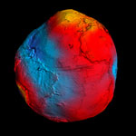
Earth's geoid
- Reference
- t-glb05-00185
- Date
- 2011-03-31
ESA's GOCE mission has delivered the most accurate model of the 'geoid' ever produced, which will be used to further our understanding of how Earth works.
A precise model of Earth's geoid is crucial for deriving accurate measurements of ocean circulation, sea-level change and terrestrial ice dynamics. The geoid is also used as a reference surface from which to map the topographical features on the planet. In addition, a better understanding of variations in the gravity field will lead to a deeper understanding of Earth's interior, such as the physics and dynamics associated with volcanic activity and earthquakes.