
Photo Agency - Astronomy - Space - Nature


> Radar view of Venus centered on the North Pole
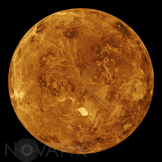
Radar view of Venus centered on the North Pole
author: JPL/Novapix
reference: a-ven06-00013
Image Size 300 DPI: 34 * 34 cm
Magellan synthetic aperture radar mosaics from the three eight-month cycles of Magellan radar mapping are mapped onto a computer-simulated globe to create this image. Magellan obtained coverage of 98 percent of the surface of Venus. Remaining gaps are filled with data from previous missions, (the Soviet Venera 15 and 16 radar and Pioneer Venus Orbiter altimetry) and data from Earth-based radar observations from the Arecibo radio telescope. Simulated color is used to enhance small-scale structures. The simulated hues are based on color images recorded by the Venera 13 and 14 landing craft. Maxwell Montes, the planet's highest mountain at 11 kilometers (6.6 miles) above the average elevation, is the bright feature in the lower center of the image. Other terrain types visible in this image include tessera, ridge belts, lava flows, impact craters and coronae.
Contact : Stéphane Aubin +33-(0)9-51-26-53-76
© Novapix - All rights reserved